ABOUT US
About GeoSurv, LLC
GeoSurv, LLC,
Registered Professional Land Surveyors, is a private practice land survey firm
offering a full range of professional land survey and consulting services to its clients. The rapid development of North Galveston County has created an ever-increasing demand for professional land survey services and GeoSurv, LLC, has grown to meet this demand.
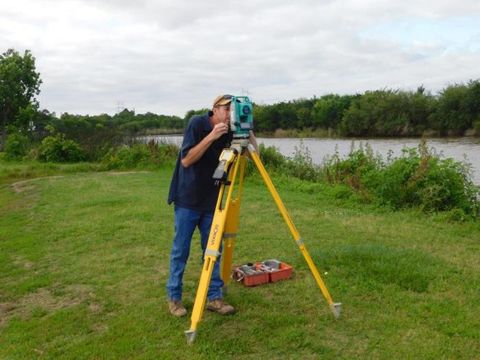
GeoSurv, LLC employs ‘state of the art’ field and office technology including total stations, data collection and computer-assisted data analysis and drafting. We provide professional land survey services which include elevation certifications, mortgage title surveys, boundary surveys, topographic surveys, bathymetric surveys, subdivision design and platting, utility route surveys and construction staking. Offering GPS survey technology since 1998, GeoSurv, LLC, continues to provide its clients with the high professional quality to which they have become accustomed. Our trained and experienced personnel maintain a higher level of quality control and product accuracy throughout the land survey process.
The management and employees of GeoSurv, LLC, are prepared to address the many and varied professional land survey requirements associated with projects ranging from large scale planned community developments to FEMA elevation certifications and mortgage surveys. We prepare certified land survey services according to the standards and specifications of the Texas Board of Professional Land Surveying Practices Act and General Rules of Procedures and Practices or the American Land Title Association / American Congress of Surveying and Mapping Manual of Practice for Land Surveying in the State of Texas.
In addition to our extensive experience with private sector survey services, GeoSurv, LLC, has also developed an active presence in the public sector offering services related to right-of-way surveys, route topographies, utility extensions, site surveys and topography, and construction control and staking. As many political entities have drafted regulations regarding tree removal and mitigation, GeoSurv, LLC, offers tree inventory surveys and mitigation planning services. Our land and survey professional address single development tracts as well as master planned development sites.
Survey and Topographic Services:
• Drainage Studies
• FEMA, CLOMR and LOMR Preparation and Application
• Corps of Engineers Permit and Documentation Requirements
• Development Of Political Subdivision
• Descriptions for The Creation or Amendment of Municipal Utility Districts
• Public Improvement Districts
• Water Control and Improvements Districts
• Management Districts
• Tax Incremental Reinvestment Zones
• City Limit and Extraterritorial Jurisdiction Boundaries
The management and employees of GeoSurv, LLC, are prepared to address the many and varied professional land survey requirements associated with projects ranging from large scale planned community developments to FEMA elevation certifications and mortgage surveys. Depending on the requirements of the task, GeoSurv, LLC, land survey services are prepared and certified to meet the standards and specifications of the Texas Board of Professional Land Surveying Practices Act and General Rules of Procedures and Practices or the American Land Title Association / American Congress of Surveying and Mapping Manual of Practice for Land Surveying in the State of Texas.
Office Hours
Mon - Thu 8:00 am - 5:30 pm
(Office Closed 12 pm-1 pm)
(Office Closed 12 pm-1 pm)
Friday 8:00 am - 12:00 pm
Sat - Sun Closed
Ph:
281-554-7739
Contact Us
Contact Us
Thank you for contacting us.
We will get back to you as soon as possible.
We will get back to you as soon as possible.
Oops, there was an error sending your message.
Please try again later.
Please try again later.


Content, including images, displayed on this website is protected by copyright laws. Downloading, republication, retransmission or reproduction of content on this website is strictly prohibited. Terms of Use
| Privacy Policy

